


Tom answers the top 10 visitor questions about the Ohio to Erie Trail
I am here to answer those questions that keep you up at night about planning a bike tour on the trail.


The Ohio cycling season is just around the corner! Many of you are already dreaming of your next tour on the trail. I've noticed a common theme in questions about the Ohio to Erie Trail. Here are 10 of the most common ones and my answers.
1. Do I head north or south?
2. How do I get back to where I started?
3. Where are the hills?
4. How do I get through Columbus without getting lost?
5. Where can I camp?
6. How many days and miles per day?
7. Where is the official start and end?
8. Where is the best place to spend an extra day?
9. Where are the closures and detours?
10. How wide of tires do I need on my bike?
1. Do I head north or south?
The experiences in both directions are nearly identical. The choice of starting point comes down to personal preference. When planning a bike tour, I consider two main factors: the ease of travel from home and the desire to explore the starting or ending point more. These factors apply equally to most of my bike tours including on the Ohio to Erie Trail.
I recommend researching travel options to Cleveland and Cincinnati, including roads, airports, trains, and other transportation. The deciding factor differs by individual. It may be price, travel time, convenience, time of year, or a combination. One city generally emerges as the starting point based on personal travel preferences.
'One more day' involves adding an extra day or two to explore a new city, allowing you to delve deeper into its culture, history, entertainment, and bike-friendly offerings. This applies to both ends of a one-way tour and offers a cost-effective way to experience an unfamiliar city on your to-visit bucket list.
Cleveland offers an array of attractions, including the Rock and Roll Hall of Fame, world-class museums in University Circle, sports arenas and stadiums, the acclaimed Playhouse Square, and interesting neighborhoods easily accessible by bike or car.
Cincinnati, once known as ‘Porkopolis’ for its rich Germanic River city history, offers many of the same attractions. The Over-the-Rhine neighborhoods, Covington, and Newport are accessible by bike. The city has a vibrant cultural scene with sports, entertainment, and museum venues.
2. How do I get back to where I started?
Most cyclists who tour the Ohio to Erie Trail cycle one-way from Cincinnati to Cleveland or the reverse. The most convenient is shuttle via a paid shuttle service. Currently, there is one shuttle service operating on the trail. You can find information about their services on the trail’s web page. It offers convenience, no hassle, and comfortable, door-to-door service.
Consider asking a relative or friend within driving distance to provide shuttle services. Renting an U-Haul, SUV, or van is another possibility, but it's important to note that rental agencies may have limited availability and less-than-ideal locations. Be prepared for higher downtown rental rates and more time and effort needed for shuttle coordination.
3. Where are the hills?
Many trail visitors are rail trail cyclists and typically not interested in conquering hills. The trail is mostly flat, and the hills are predominantly in Wayne County. Ohio is not Colorado, and the hills are not the Rockies. Expect a few hills with most being rollers.
Wayne County hills are short in distance, generally under 5% grade, and of shorter elevation. There is no shame in walking or using granny gear to climb surrounded by the beautiful Amish countryside.
Both northbound and southbound routes experience a gentle incline as they rise from the river or lake. This includes a gradual ascent from the Ohio River valley in Cincinnati to Xenia and a similar incline from the Lake Erie shore in Cleveland to Akron. These climbs are unnoticeable but are an easier cycle descending in the opposite direction.
The remainder of the trail follows former railbeds and canal towpaths with little to no elevation. You may encounter a climb but know that it is minor and comes with a reward at the crest on achieving that climb with a story to tell.
4. How do I get through Columbus without getting lost?
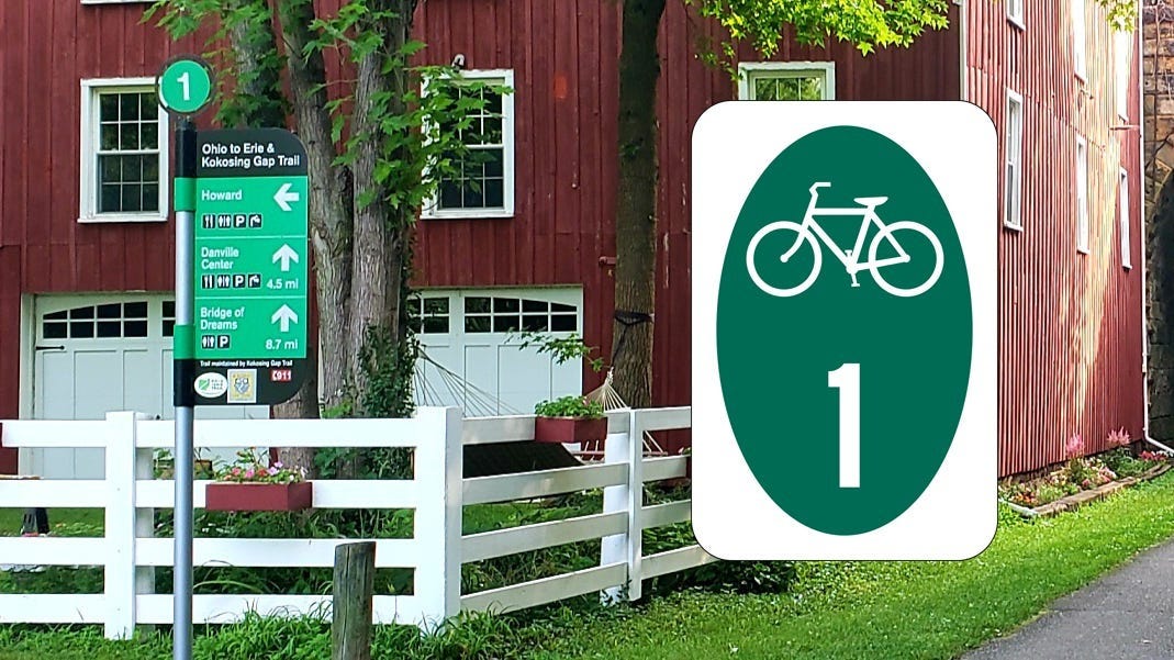
The Ohio to Erie Trail passes through Cincinnati Columbus, Akron, and Cleveland. In these large urban areas expect to pay close attention to your Ohio to Erie Trail Guide, Ride with GPS navigation, or Google Maps. When I cycle into cities, I take time the night before or before mounting the bike in the morning to preview the route for the day. I expect some transitions between trails, shared on-street cycling, and busy roads, intersections, and trails.
The Ohio to Erie Trail Ride with GPS files and the interactive map are accurate with every effort made to be current on detours and closures. A good rule of thumb is to follow Ohio-1 signs but don’t solely rely on them. Check the map and the route on your phone. My intuition tells me if I’m going the wrong way, especially when signs disappear, and fellow cyclists are sparse.
This logic is similar to if you were driving your car through an unfamiliar city. You pay attention to the highway and street signs and your car’s navigation. You have that responsibility on the road. You have the same ownership when on the bike.
5. Where can I camp?
Primitive or stealth camping is prohibited on all Ohio trails that I know of. Campgrounds near the trail are listed on the Ohio to Erie Trail website. Warm Showers and Hip Camp are also excellent resources for finding camping options.
Disregarding this stealth camping regulation could result in consequences. In urban areas, stealth camping is not only discouraged but also carries increased safety risks.
6. How many days and miles per day?
Your daily mileage on the trail depends on several factors, including your comfortable cycling distance, the type of overnight accommodation you prefer, and the amenities you desire at night. Most cyclists complete the Ohio to Erie Trail in five to seven days, with towns and cities conveniently located roughly 40 to 60 miles apart.
The Ohio to Erie Trail website offers a variety of suggested itineraries with overnight options to suit most visitors' needs. Each of these towns and cities offers unique local flavor and something for everyone to enjoy.
7. Where is the official start and end?
The official southern terminus begins at the foot of the Roebling Suspension Bridge in Smale Park on Cincinnati's riverfront. The bridge's distinctive stone supports and cables, designed by the same Roebling who designed the Brooklyn Bridge, make it recognizable among the city's other Ohio River bridges.
The northern terminus is located in Edgewater Park in western Cleveland. Ohio-1 signs will guide you along the lakeshore to the park and the Cleveland script sign. The transition from the Ohio and Erie Canal Towpath Trail to the park requires careful attention to signage, maps, and navigation, as there is a short section on city streets. Cleveland is actively working to create a continuous trail experience to the lake.
8. Where's the best place to spend an extra day?
As I previously mentioned, adding an extra day in either Cleveland or Cincinnati offers a great big-city experience. The same applies to Akron or Columbus, both offering similar attractions, activities, and amenities.
Xenia is another excellent option. As a former railroad hub, it provides easy trail access to Dayton (about 20 miles) and its attractions, including the Wright Brothers Museum and the National Museum of the United States Air Force. Nearby Yellow Springs (about 10 miles) is an artsy town with a unique flavor, home to Young's Jersey Dairy and a short cycle to historic Clifton Mill.
For a smaller city experience, Mount Vernon and Massillon are popular overnight stops. From Massillon, a 20-mile ride will take you to the historic Zoar Village and its beautiful communal gardens.
Akron is a great base for exploring the Cuyahoga Valley National Park. Take the Cuyahoga Valley Scenic Railroad to the National Park Visitors’ Center at Boston Mills or Peninsula, then cycle back to Akron and explore the park's numerous hiking trails, including one to Hale Farm and Village, just a few miles from the Beaver Marsh.
9. Where are the closures and detours?
Closures and detours are sometimes unavoidable on a trail network like this, especially ones with sections over 20 years old, often following rivers and waterways susceptible to erosion. Bridges require repair or replacement and trails themselves need maintenance.
The Ohio to Erie Trail organization makes a significant effort to stay informed about closures, detours, and construction. However, this is a network of over 20 trails spanning 15 counties and numerous jurisdictions, so occasional communication delays or oversights can occur, though these are rare.
Always check the Ohio to Erie Trail website for current closures highlighted on the homepage. The Ride with GPS files and interactive maps are regularly updated to reflect closures and detours. Ensure you have the most recent versions when you use these resources.
If you encounter a closure or detour, prioritize your safety. Trail organizations may not provide detours, particularly on busy roads with limited visibility or no shoulders. If you choose to proceed on such a route, exercise extreme caution. Remember, if a detour hasn't been provided, it's likely for safety reasons.
10. How wide of tires do I need on my bike?
This trail is neither a mountain bike trail nor comparable to the natural gravel and clay surface of the Chesapeake and Ohio Canal Trail. The surface is almost entirely paved or chip and sealed. The Ohio and Erie Canal Towpath Trail from Massillon to Cleveland is primarily packed limestone with some paved sections in urban areas.
While cyclists have used narrower road tires successfully, a wider gravel or hybrid tire is recommended for comfort and safety. The choice of tires is a personal preference. This trail is not a muddy or gravel route; it's an accessible route for cyclists of all abilities.
Bonus. Where do I get more information?
These are the top ten questions I am frequently asked about the Ohio to Erie Trail. They are the same questions I ask myself when embarking on a new tour in an unfamiliar location. You can find additional information in the FAQ section of the Ohio to Erie Trail website. I hope they are helpful as you plan your Ohio to Erie Trail adventure!
I encourage you to follow the trail’s Facebook page and YouTube channel. We've compiled a collection of Ohio to Erie Trail "how-to" posts and videos by the trail and fellow cyclists. There's also an active Facebook fan group where you can connect with others and ask questions.
Have a wonderful time exploring the Buckeye State!
Good post!
New question: how can I be sure I won't get rained on? ;)